Superimposing maps
Argonautica provides a wealth of different information. In many cases, it is beneficial to compare them by superimposing the various maps available on others, including those showing positioning data. By viewing maps successively (i.e. creating an animation sequence), either on their own or superimposed on others, it is also possible to highlight oceanographic phenomena and explain a buoy or an animal's movements.
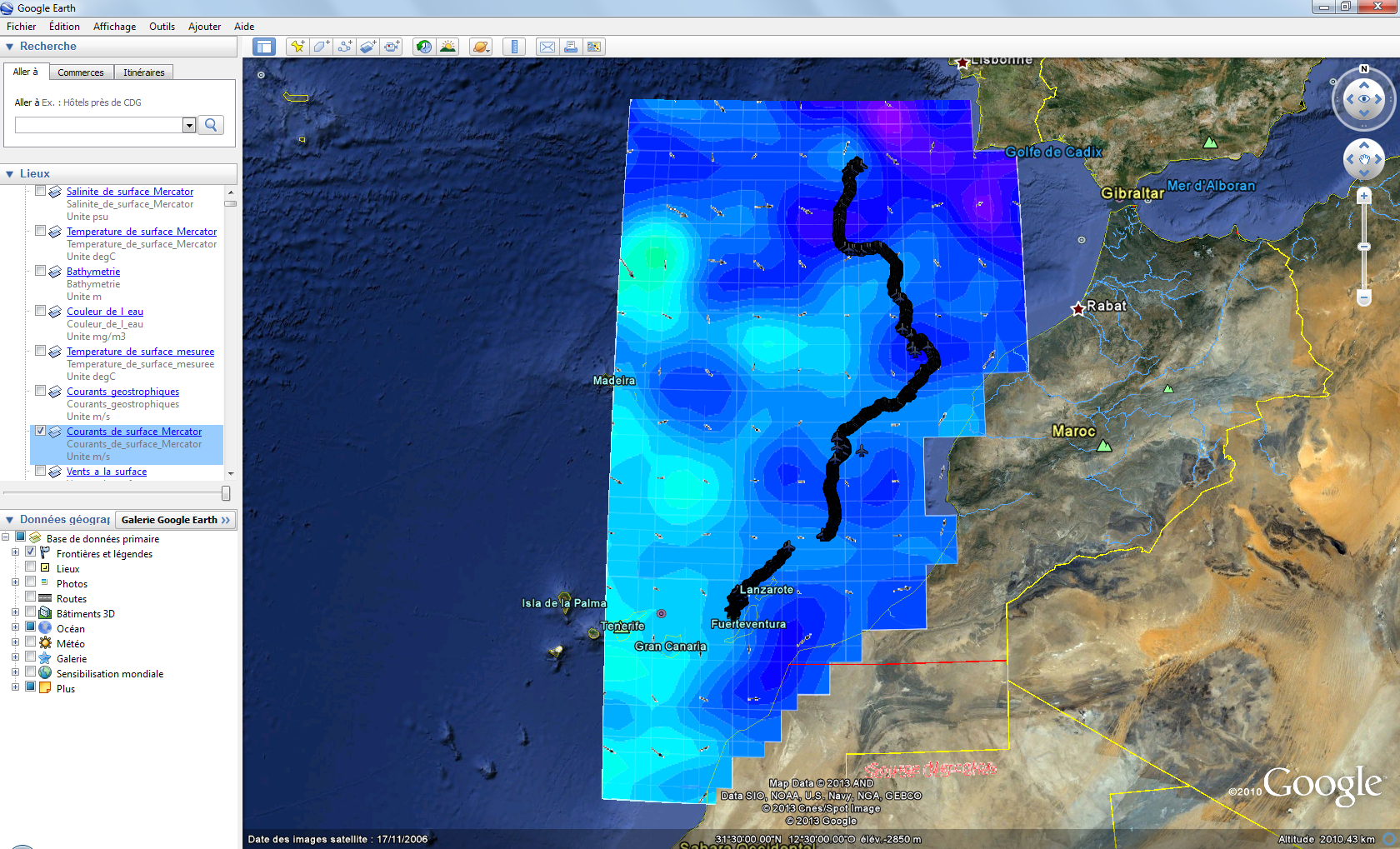
Google Earth
The Google Earth interface has been designed to superimpose three types of information:
- "colour" maps
- with "contour/vector" maps
- with points showing the beacons' movements ("trajectory" maps)
To exploit these features open the ".kmz" file proposed for each beacon and each date (with the maps). Click on the map(s) you want to view. The available trajectories are displayed as soon as the file is opened.
Watch the tutorial (in French)
Image-editing software
Suitable software such as Paint.NET or GIMP is free of charge (commercial equivalents: Photoshop, PaintShop etc.) This type of software works with layers. If you open a colour map, then copy and paste a trajectory map or a contour/vector map onto a new layer, this information will be superimposed on the original map. In some cases (GIMP), you will need to change the number of colours (from "indexed" to "true colours") or the colours of the second map will be limited to those used in the first.
For example, open Paint.NET then drag first the colour map into the software, followed by the second map that is to be superimposed on it. The following window is displayed: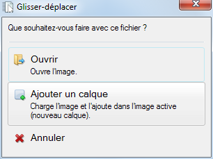
By selecting "add a layer", the two images are superimposed. The result is ready to be saved.
Watch the tutorial (in French)
Presentation software
This kind of software allows you to incorporate images on "slides". Argonautica maps can be superimposed by incorporating two images at the same time (a transparent map over the other map). This is not necessarily the fastest or most convenient method, because the images are not automatically aligned (it is better to precisely adjust the images using the "size and position" menu).
Watch the tutorial (in French)