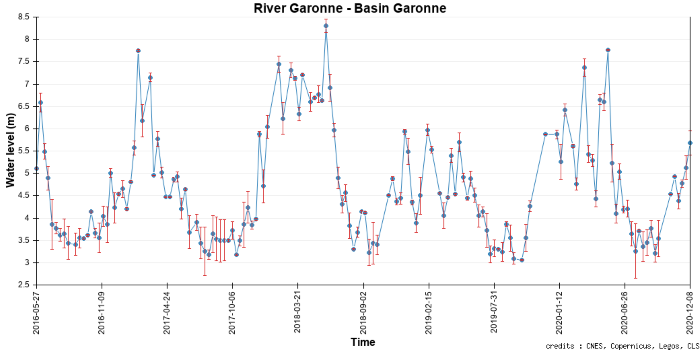
Water heights
Lakes and rivers anhave variable water levels, depending on the season with a similar cycle every year, but also depending on the year due to more intense rainfall or, on the contrary, droughts than usual. The causes of these variations may be local, or they may occur upstream, sometimes very far from a given point - a famous historical example being Egypt before the construction of the Aswan dam, with the Nile flooding every year in the middle of a very arid desert, the rain having fallen much further south. In temperate climate zones, snowmelt can swell rivers in spring, possibly in addition to rainfall, and may continue to supply water for part of the summer. Lakes vary with the rivers that feed them, but there may also be dams that regulate water levels, or excessive water withdrawals at lake level or upstream that dry them out - sometimes catastrophically (Aral Sea, Dead Sea).
Orders of magnitude
The heights of lakes and rivers vary from a few tens of centimeters to several meters (10 to 12 meters, even up to 16 m, every year during the rainy season for tropical rivers such as the Amazon).
Measurement techniques
Satellite measurements
in situ
Automated measuring stations are installed on many lakes and rivers. A graduated ruler can also be used (non-automated).


