The currents
Currents warm up the cold zones and evacuate the heat from the hot zones, thus spreading out the energy provided by the Sun. Water is heated by the Sun in the Topics. Prevailing winds (trade winds from the East below the Tropics, West winds in the mid-latitudes), and temperature differences between masses of water cause this water to move towards the upper latitudes. During the trip the water loses its heat to the atmosphere and the ocean environment. This causes a spreading of the heat over the entire globe, which is essential for the genesis of the various climates.
The major ocean currents generated by the prevailing winds are deviated by the coasts and by the Earth's rotation. In this way, the oceanic circulation accumulates water along the western fringe of the oceans. The ocean surface currents follow the ocean's topographic contours at a speed proportional to the slope. In the Northern hemisphere, currents rotate clockwise around the bumps and inversely around the hollows; the opposite is true in the Southern hemisphere.
Moreover, oceans move and vary around the world. There are places that are more turbulent than others, mainly in the stronger currents located close to the ocean's western shores: Gulf Stream in the Northern Atlantic, Malvinas Current in the Southern Atlantic, Kuroshio near Japan and the Agulhas Current in the Indian Ocean, South of Madagascar. The strong variations observed in these zones are due to a strong eddy activity caused by the instability of these powerful ocean currents. In their neighbourhood, the sea surface height variability caused by eddies ranging in diameter from a few tens of kilometres to hundreds of kilometres can reach thirty centimetres. The Antarctic circumpolar current is also very active because it does not encounter any continent.
On the other hand, there are places along the equator that have little or no variations. Other intermediate zones have more intermittent phenomena than currents; this is the case, in particular, of the equatorial Pacific where the El Niño phenomenon occurs.


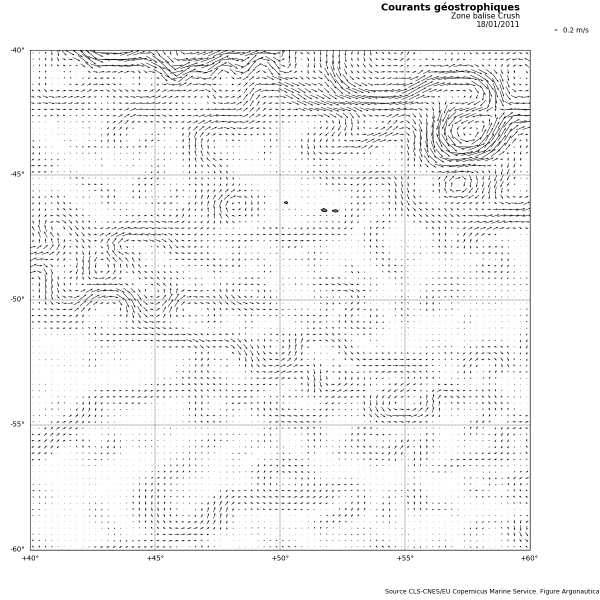
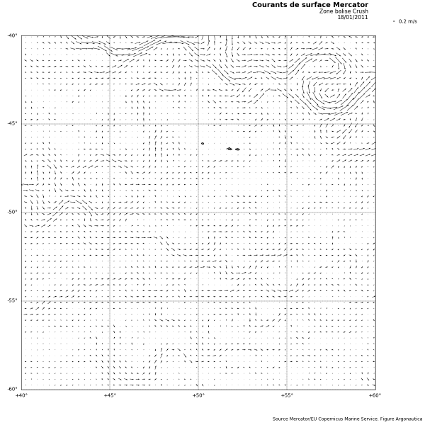
Geostrophic current map (calculated using ocean topography) and surface current maps (produced by the Mercator model) on 18/01/2011 in the "Crush" penguin zone. (CLS-CNES - Mercator /EU Copernicus Marine Service - Figure Argonautica)
Orders of magnitude
Currents are measured by oceanographers in metres per second, even though seamen commonly speak in terms of knots and the rest of us use km/h. Setting aside the strongest currents, typical speeds are of the order of 0.5 to 1 m/s. They can, for example, be greater than 2 m/s in the Gulf Stream.Measurement techniques
Satellite measurements
The global oceanic circulation is shown as hollows and bumps around which the currents wind. Currents rotate clockwise around the bumps and inversely around the hollows in the Northern hemisphere (exactly the opposite happens in the Southern hemisphere). Altimetry, used to measure differences in sea surface height, allows us to observe the currents. Note, nevertheless, that currents determined using altimetry are calculated according to the ocean's topography (these currents are called "geostrophic"). They do not take the direct effects of wind on the masses of water into account. Geostrophic currents produced using altimetry measurements can be quite different from the "actual" current.
We can also determine currents using other satellite techniques insofar as the spreading of the heat, salinity and chlorophyll content depends on oceanic circulation.
Ocean measurements (in situ)
Ocean measurements are made by oceanographic ships during measurement campaigns, using drifting buoys deployed during scientific missions at sea, as for the Argo network, or anchored buoys such as TAO, PIRATA, etc.
The parameters measured correspond either to a current a few metres below the surface (drifting buoys equipped with a sea anchor are more subject to the subsurface current than the wind driven surface current), a current at 1000 m in depth (Argo floats), or a current at different depths (anchored buoys).
Models
Current measurements are one of the essential parameters produced by ocean models..

