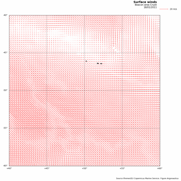
Winds

Wind map for 18/01/2011 in the "Crush" penguin zone. (Ifremer/EU Copernicus Marine Service - Figure Argonautica)
Ocean surface winds, along with other atmospheric events; solar energy, rainfall, evaporation, are forces that affect the movement of masses of water in the ocean and result in ocean currents and circulation.
Marine winds shape the oceanic seascape and cause it to go from a calm flat sea to mountains of water during storms. They also affect the mood of seamen and inspire legends about the ocean.
Orders of magnitude
According to the maritime tradition, wind is expressed on the Beaufort scale, from 0 (no wind) to 12 (hurricane).
The Anglo-Saxon tradition dominates seamen's habits as they express the speed of wind in knots or nautical miles per hour (1 nautical mile = 1.852 kilometres). During hurricanes, the wind speed can be greater than 80 knots, which corresponds to more than 150 kilometres/hour in the metric system, or more than 40 metres/second.
Measurement techniques
Data on winds determined from today's satellite observations have high spatial precision and are measured frequently. Moreover, wind data resulting from numerical weather forecast models provide spatial and temporal consistency in atmospheric dynamics that satellite measurements cannot provide. Methods combining both sources now let us generate wind data with optimal quality.
Satellite measurements
Several types of satellite sensors allow measurement of sea surface wind:
- Scatterometers
- " Microwave radiometers
- " Synthetic Aperture Radars (SAR)
- Radar altimeters (only for wind strength, but not its direction)
Models
Numerical weather forecast models also provide knowledge of surface winds. Nowadays, there are many different models.

