Possible uses for Argonautica data
Here are some possibilities
Observation of animal behaviour
Most of the animals tracked with Argonautica, depending on each species, move around in a typical way. For example, king penguins on the Island of Crozet are quite "predictable". Albatrosses can be more surprising with trajectories circumnavigating Antarctica in just a few months.
Trajectories can be studied individually as can the corresponding cartography but also in relation to other information about the ocean environment (currents, temperatures chlorophyll content...).
Example of sea turtle "Vita" (comments in French, please activate sub-titles)
See more at the Chizé CNRS site
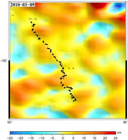
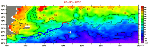
Understanding beacon trajectories
Trajectories, whether of animal or oceanography beacons, can be compared with the oceanographic maps provided. Depths, winds, currents, temperatures and many other elements can have an influence (though chlorophyll content does affect animals more). By superimposing beacon trajectories on the different maps, we can determine whether or not there is any relationship and if so, try and understand it.For more information, see the following feature pages (in French, except for the first one):
Example of "Pégase2019" buoy (comments in French, please activate sub-titles)